 Lataa PDF
Text by: Pertti Rovamo (translated by Inna Aladina) Photos by: Pekka Pouhula
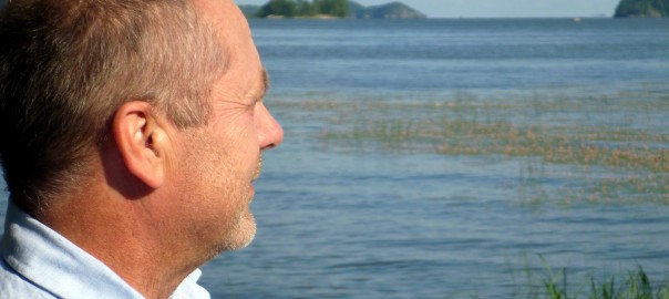
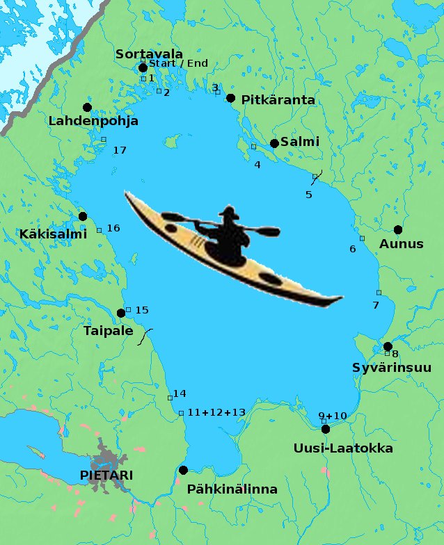
The first time an experienced Finnish kayaker Pekka Pouhula (aka Pörrrhölä in the kayakers` community) saw grand rocky landscapes and endless water face of Lake Ladoga was on the Midsummer`s eve in 1999. Together with his Russian sweetheart Rita, he went to celebrate this holiday to a sandy beach on the northern shore of Ladoga. He fell in love with Ladoga at first sight. That was the moment when the dream to take a kayak trip around Ladoga was born. That dream came true in summer 2011. The tour took 18 days and 573 km of paddling. Pekka spent most of the tour alone.
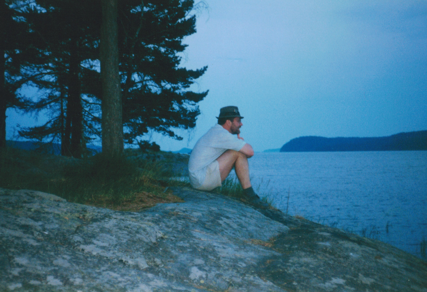
Midsummer`s eve 1999. On a rocky shore near the village of Vuorio.
By the time the tour started, Pekka had already explored the northern part of Ladoga famous for its skerries and fjords, either alone or with a bunch of friends. The crucial general rehearsal of Ladoga tour took place on another big lake, Lake Onego. In summer 2010, Pekka and his fellow Risto Partanen, also from Rantasalmi, Finland, made the tour around Onego. Pekka went by his kayak, and Risto chose the 5-meter-long wooden boat, handmade by a craftsman from Kesälahti Arvo Ketolainen. The tour lasted 2 weeks with the overall distance of 450 km. Pekka started to have a lingering hope that Ladoga can also be kayaked around.
Rita, a resident of Sortavala, introduced Pekka to the local lifestyle and neighborhood. She never accompanied him during kayaking trips, but during short-time outings she kept his company with pleasure.
The tour around Ladoga was not only a test of Pekka`s physical abilities, but also an immersion into the history of Russia and Finland, as the tour passed through some significant historical sites.
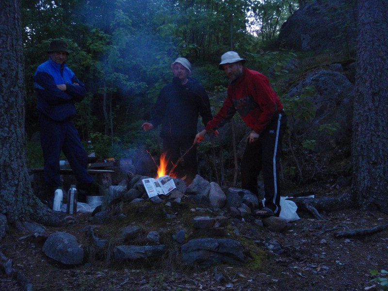
Beginning of the tour in the company of two row boaters
Pekka came up with a single trip, because it came out that no one of his friends was ready to sacrifice their summer vacation. An additional problem was that no one could predict precisely how many days such a trip would take. Weather is something you don`t choose. A sensible guess was that the trip would last about 3 weeks or more. Lake Ladoga is really huge, and over its endless water face the wind is the determinant factor of getting ahead.
Conducting the trip alone brought certain difficulties with food supply. Although there were some villages on the lake shore, one couldn’t just leave all the gear and go to a shop.
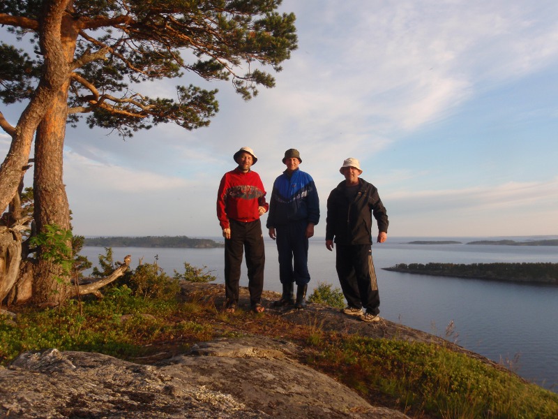
Risto Partanen, who accompanied Pekka on the Onego tour previous summer, suggested he would join the first part of the tour. He also tempted another citizen of Rantasalmi Erkki Muukkonen to come along. Erkki has a summer cottage on the eastern shore of Ladoga and a motorhome that could be used later on to deliver provisions.
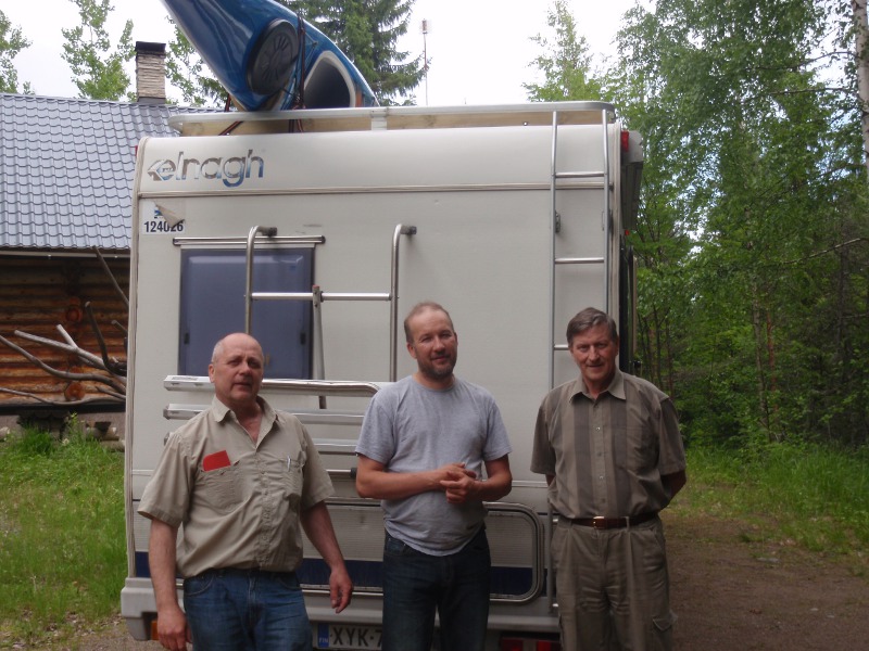
The official start photo of Pekka Pouhula, Risto Partanen and Erkki Muukkonen
Sortavala – a small and vibrant cultural centre
The tour started in Sortavala, a small town located on the northern shore of Lake Ladoga. Sortavala was founded in 1632, right after Sweden had conquered the Käkisalmi county of Russia.
A century later, Sweden lost that territory, and Sortavala lost the status of being a town. The pendulum of history swung to a new position, when in 1809 Finland including the territory of Sortavala was included into the Russian Empire. Thus so called Old Finland, conquered in the XVIII century, became a part of a new administrative unit within the Russian Empire, the Grand Dutchy of Finland. In 1811, this event predetermined formation of Finland, which Finns believe to be the only, original, and true Finland.
Sortavala grew into a cultural and spiritual center of Ladoga Karelia area. There functioned a men’s and a women’s pedagogical seminary, where a significant part of all Finnish folk school teachers were educated. The town had prosperous industry and a big trade harbor. Although Sortavala wasn`t the biggest settlement of Finland, it was of great importance being a cultural center. In 1939, the population of Sortavala was about 10 000 people. Nowadays about 18 000 people live there.
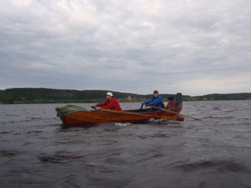
Risto and Erkki started their route vigorously
So, friends started from the Piipunpiha hotel, located on the lake shore, on the 23th of June at 9.50 P.M. Travel arrangements took more time than had been planned, but still it was decided to start the tour the same day, just to take on a rhythm. Erkki`s motorhome was left at a hotel parking, which cost 200 rubles (around 5 euro per day).
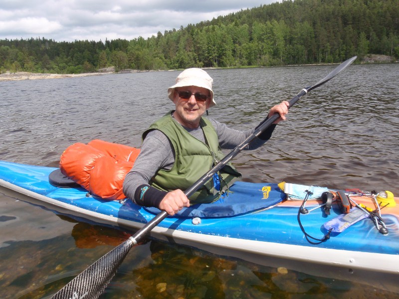
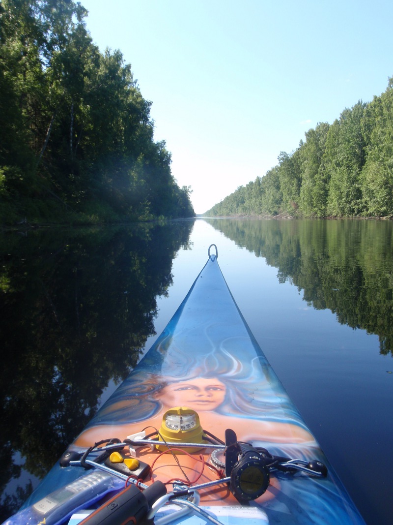
Pekka at the start. 3 weeks of kayaking are ahead
Midsummer on the Vahtimäki rock and war memories on Petäjäsaari Island
Sortavala`s most magnificent sceneries are in the Honkasalo fjords and Vahtimäki rock (meaning Watch Rock in Finnish). The travelers landed on an island and climbed the top of Vahtimäki rock to celebrate Midsummer`s eve. In 1893, traveler, photographer and writer I.K. Inha was exactly at the same place imprinting landscapes in photographs. From his point of view, those were the most notable travelling destinations of Finland, alongside with Imatra waterfall, Paanajärvi lake and Punkaharju ridge.
Expedition to a historic site on the eve of the Midsummer
Vahtimäki was one of the watch rocks, which helped to warn about enemies by lighting fire on the top. Vahtimäki is 75 meters above Ladoga level.
The travellers burned a small bonfire, like local people did centuries ago. They knew that for making bonfire they could get 2 000 ruble fine, but this regulation does not usually prevent them or other tourists from making fire.
Midsummer fire, men tremble with fear of fines
Additionally, Risto defied another law: he put a fishing net in the lake before going to sleep, and in the morning, the travelers had three big perches and several small whitefishes for breakfast. The amount was not too big for poaching, but such a variety to tourists` meal is always warmly welcome.
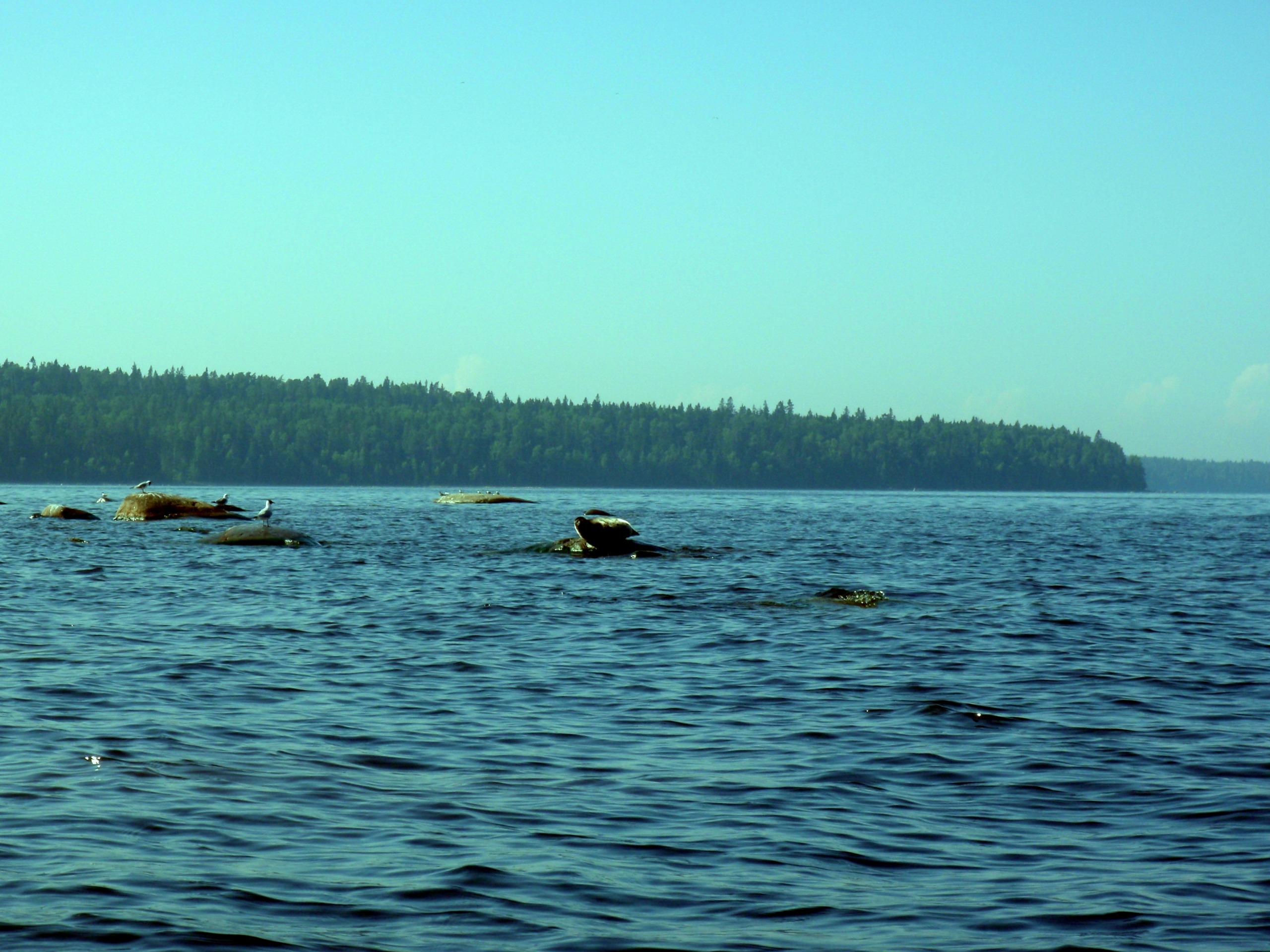
On the Midsummer Day, travelers saw a herd of 20-30 Ladoga seals, resting on the rocks. In the evening, they set a camp on Petäjäsaari Island.
Petäjäsaari is situated within an archipelago near the town of Pitkäranta. The island is one and a half kilometers long and a half kilometer wide. For the citizens of Rantasalmi, Petäjäsaari is a significant and touching place. Seven days before the end of the Winter War (the war between Finland and the Soviet Union within the II World War), on March 6, 1940, there was a bloodshed battle that took away lives of 117 Finns. There were fought literally to the last man. All wounded survivors were later evacuated.
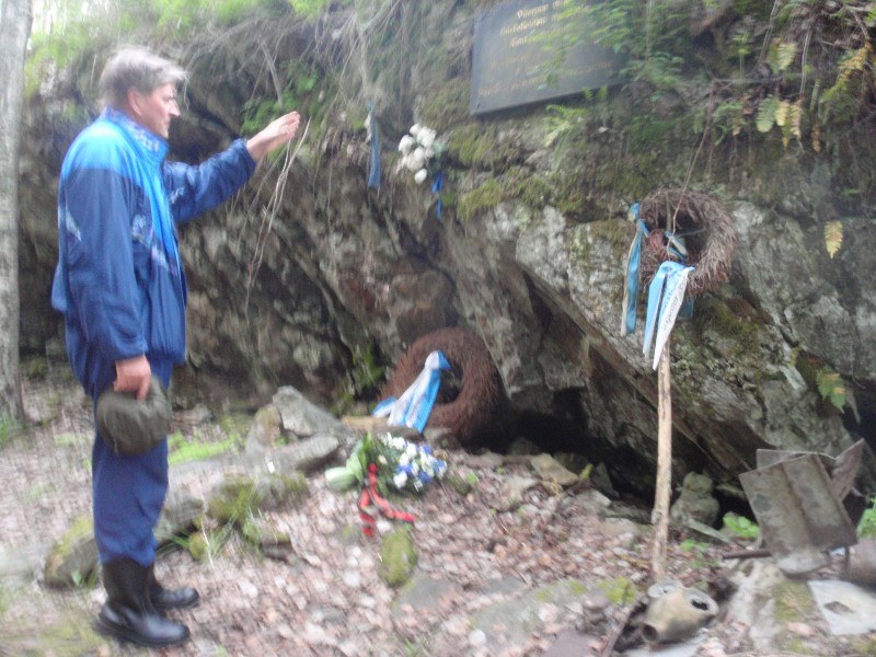
Erkki holds a speech at a Finnish memorial and presents pieces of war history
46 of them were from Rantasalmi, and 23 were from Nilsiä. Human losses of Rantasalmi became the biggest loss for one municipality in one day.
”We visited the residents of Rantasalmi and the memorial plaque at the Russians memorial. Even now, when we walked on the island, we felt shell splinters under our feet,” says Pekka Pouhula.
Maybe it was because of those war memories, but around midnight Pekka heard someone walking by his tent, and Erkki heard some metal clang. Or was it just a dream?
Next day, Erkki and Risto went to a shop in Pitkäranta, and Pekka stayed on the shore keeping an eye on the boats and gear. It started raining, and the travelers decided to spend the last night together at a tourist village on Lunkulansaari Island.
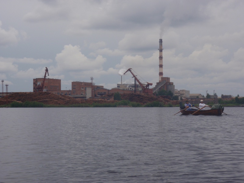
The island of Pusunsaari. Paper mill industrial area
It cost 5000 rubles (about 120 euros) to rent a decent cabin with a sauna. It was nice to sleep on real sheets for a change. Next morning, Risto and Erkki went their own way back to Sortavala, and Pekka continued his trip around Ladoga alone.
Difficulties and hospitality
The lonely man’s journey started gloomily. It was getting foggy, so Pekka had to rely on his GPS navigator. Head wind was blowing 3-6 m/s, although the forecast was different. Lunch break felt clammy and miserable. It soon became clear that things were even more miserable.
”Waves were going rather high, and water was getting all the time inside my kayak through the sprayskirt, that wasn`t set tightly. I fixed the skirt, but it did not seem to help – all my stuff was getting wet. I realized there was a leak somewhere in the kayak,” he says.
”When I was pulling off from the shore, waves pressed the kayak against a rock, resulting in two small rifts. The kayak was heavily loaded, bearing 60-80 kilos of gear and myself, so it wasn`t surprising that light and thin material cracked.”
”I removed water with a sponge every fifteen minutes. In the end, about 6 o`clock I found a site with benches, a table and a fireplace. I got ashore. After a while, an angry dog came barking, and later on an angry man showed up. He explained that I was not allowed to come ashore there. When I opened my mouth and said something in my poor Russian, the man asked, ”Finland?” ”Da, da,” I replied.
”The tone changed immediately. I was allowed to stay on the shore. The man introduced the dog as Nika and himself as Roman. He brought me some firewood and I made a fire. I patched the rifts using diolen patches and epoxy. They worked quite well till the end of the trip.
I made a midnight snack, put up my tent and was getting ready for sleep when Roman came back. She had called her mother, Olga. She told his son to heat the sauna. Soon, they offered food and vodka. Forced to sleep in sauna rooms, even the tent would have been nicer to me. Communication became easier, when Olga called a Finnish talented friend in St. Petersburg, who translated for us by phone. I also charged my cell phone.
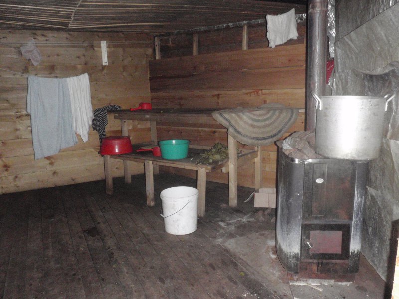
The sauna, a massage table and a large tub on the left. Steam was amazing.
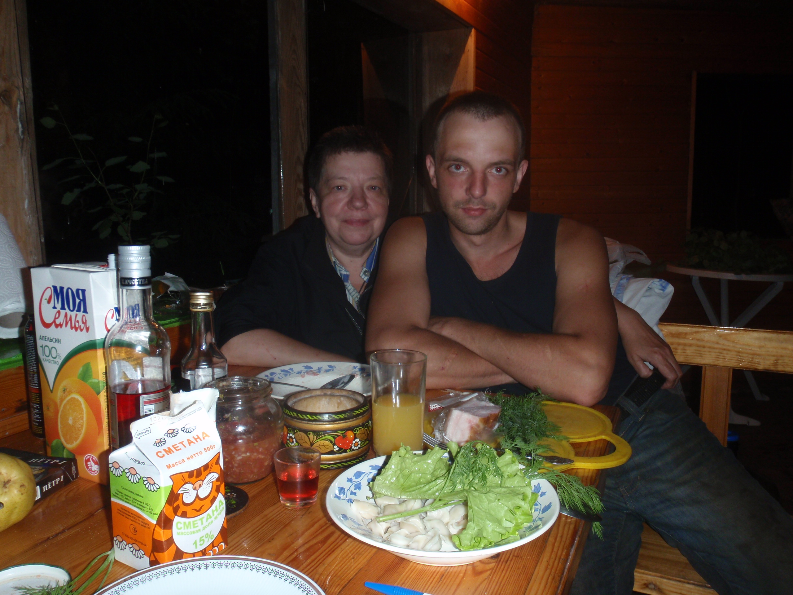
A “small” dinner after the sauna. Great steam bath.
In the morning, I was offered porridge and goat’s milk. In the yard, there were pigs, chickens, goats, sheep, rabbits, pheasants, and quail. For a goodbye I got a hug and a fresh chicken egg right from a hen.”, describes Pekka.
Olga and Roman’s dacha was in Rajakontu, where the border between Finland and Russia was until 1940. Ladoga 1811-1940 was divided roughly in half between Russia and Finland.
Along a sandy eastern shore
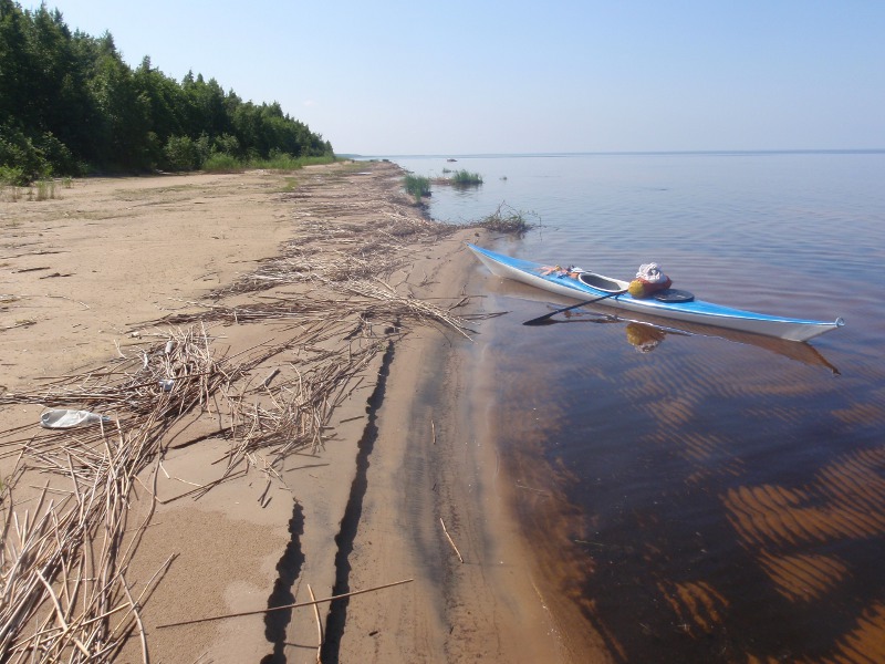
During the day, Pekka covered quite a long distance along the sandy shores near Olonets. As he was approaching the Svir River mouth, shores were getting more and more reedy. There was no suitable place for a night camp. Finally, Pekka found a small sandy bay and got ashore.
Such a landscape can be seen for 100 km.
That night, the previous evening`s situation repeated, however, with some frightening shades.
”I had already pitched my tent, when I noticed a fishing hut in the nearby woods. I approached the hut and helloed. No answer. The door was ajar, and I opened it a little bit more. I heard voices inside. Wondering what to do, I returned to the shore. I was tired, I did not want to continue my way that day anymore, because I had already changed to dry clothes, and I was not sure how far it would take to the next suitable place for a night camp. Finally, I decided to stay. I thought it would be reasonable to report to the hut inhabitants, that there would be a tourist staying overnight on the shore.
The hut (night picture)
I knocked on the door, and a man appeared on the threshold. He was about 30 years old, drunk and wearing underpants. But once I started to speak, he replied friendly: ”Finski turist?” (”Finnish tourist?”). He invited me inside and offered some tea. There was also a woman who was introduced to me as his wife. They started to persuade me to spend the night on a plank bed inside the hut. I explained my refusal with the fact that I had already pitched up my tent.
The man had a stitched wound under his eye, and the woman limped. Getting to sleep, I took a puukko knife with me to the tent. But the night passed calmly, and I slept well: the air was cool and fresh.
In the morning, the man complained of a hangover. I prepared my breakfast quickly and, as quietly as possible, packed my stuff and left. I decided that it would be better not to attract unnecessary attention to my departure.”
“After this trip, I told my friend Risto Partanen about that evening; he speaks Russian well and knows Russian culture much better than me. Risto commented, that if he were in my shoes he would not have knocked on the hut door. Rita also noted that my actions tended to be too self-confident and, let us say, thoughtless. However, in general, in their opinion, it was relatively safe to move around on the sparsely-populated countryside in Russia.”
Analyzing both cases, Pekka came to the conclusion that Russians mostly regard to Finnish tourists with some respect. At least, he received warm reception at accidental meetings. It would be nice to see a similar attitude to Russian tourists in Finland.
Pekka considers hospitality to be one of the most typical features of Russian culture. When a guest comes to a house, he/she is taken care of in every possible way. When Russians offer help to a Finnish tourist, they do not expect any reward, since they do it out of hospitality. However, you can always offer some money as a sign of gratitude, but if a Russian refuses, you should never insist, since this can be perceived as an insult. An excellent option is to have a return gift in stock, but as it is not difficult to understand, on a many-day kayak trip, you cannot take a lot of extra stuff with you.
Olonets, traditional Karelian territory
So-called Olonets Karelia, located south of the old Finnish border, never used to be a part of Sweden or Finland, except for a few years during the Second World War, when it was occupied. This is the land where Karelians traditionally lived.
The town of Olonets is one of the oldest settlements in the North of Russia. The first written mention of it dates back to 1137, what is 10 years earlier than the first mentions of Moscow.
Olonets is not located on Lake Ladoga shore, but is further inland, at the confluence of the Olonka and the Megrega rivers. Today, the town`s population is 11.5 thousand people. Approximately 60% of them are Karelians, and about 10% are Finnish speaking. Thus, in the Olonets area, it is quite possible to manage only with Finnish – you are quite likely to be understood.
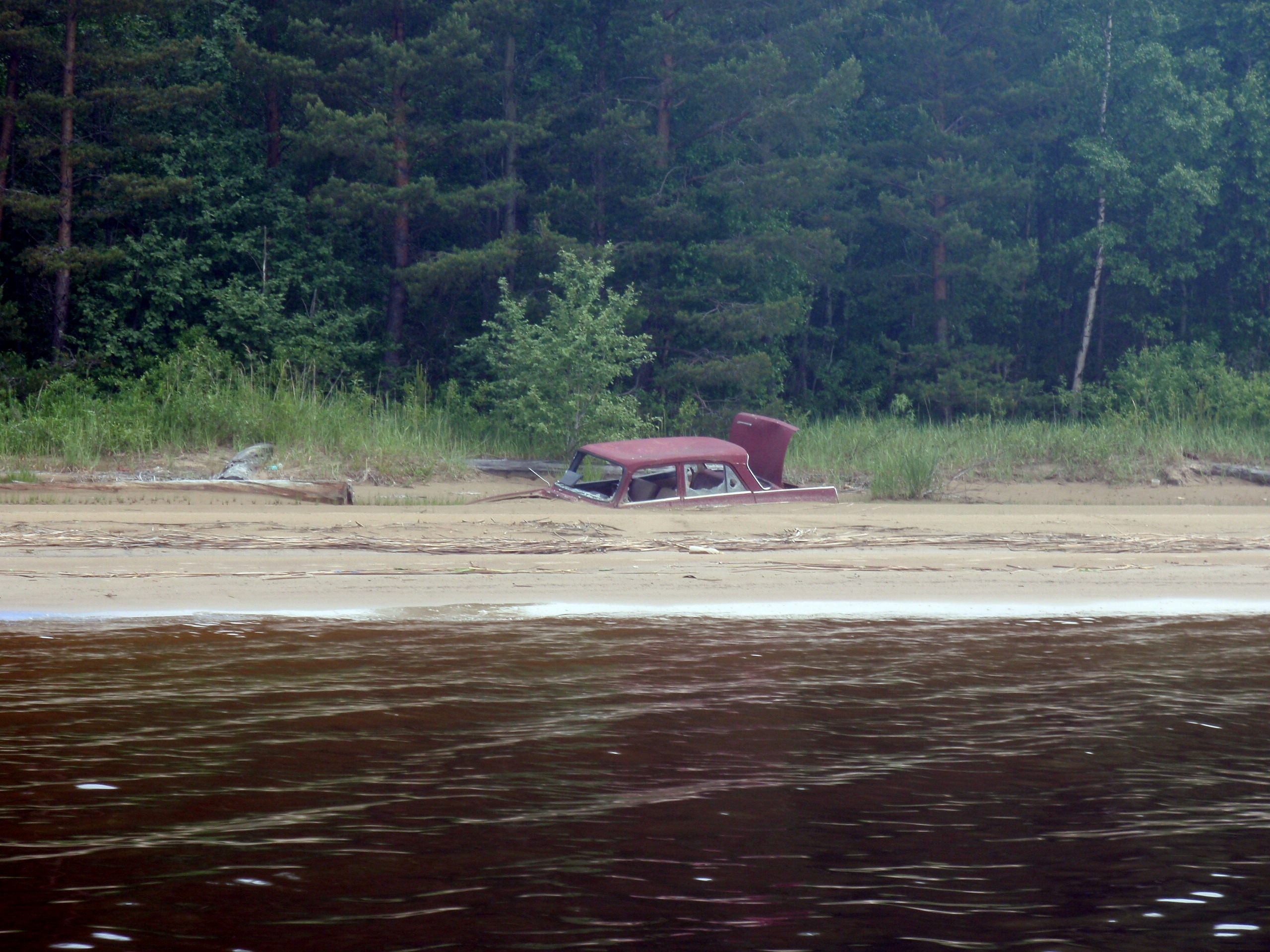
Someone went fishing and never returned to get the car
After Olonets, the shores of Ladoga turned out to be more and more difficult for a kayaker: a wide belt of reeds occupied the coast waters, and it became increasingly wider.
So, Pekka had to make his way to the shore through dense reeds. He knew that soon there would be the territory of Nizhnesvirsky strict nature reserve in front of him, where it was not allowed to stay overnight. At the same time, he would not manage to get to the Svir mouth by nightfall.
Kayak in a ”dock” in the kingdom of horseflies
The shore was so bad that Pekka had to unload his kayak standing right in the water in the middle of the reeds. Those reed jungles were home for thousands of horseflies and other blood-sucking insects. Next morning, with similar difficulties and still surrounded by horseflies, he packed things back into the kayak and started on.
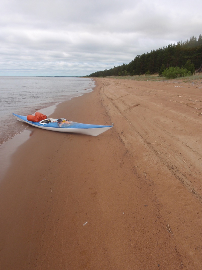
Sandy beach of Svyr Nature Reserve
By the evening, I reached the mouth of the Svir River, which connects Onego and Ladoga lakes, and settled in hotel ”Svirskaya”. A friendly hotel owner volunteered to help me unload my stuff from the kayak. Rita helped solve the difficulties of communication by phone.
A night in the hotel cost only 2 thousand rubles, breakfast – 250 rubles. It was about 55 euros, as to the exchange rate of that day.
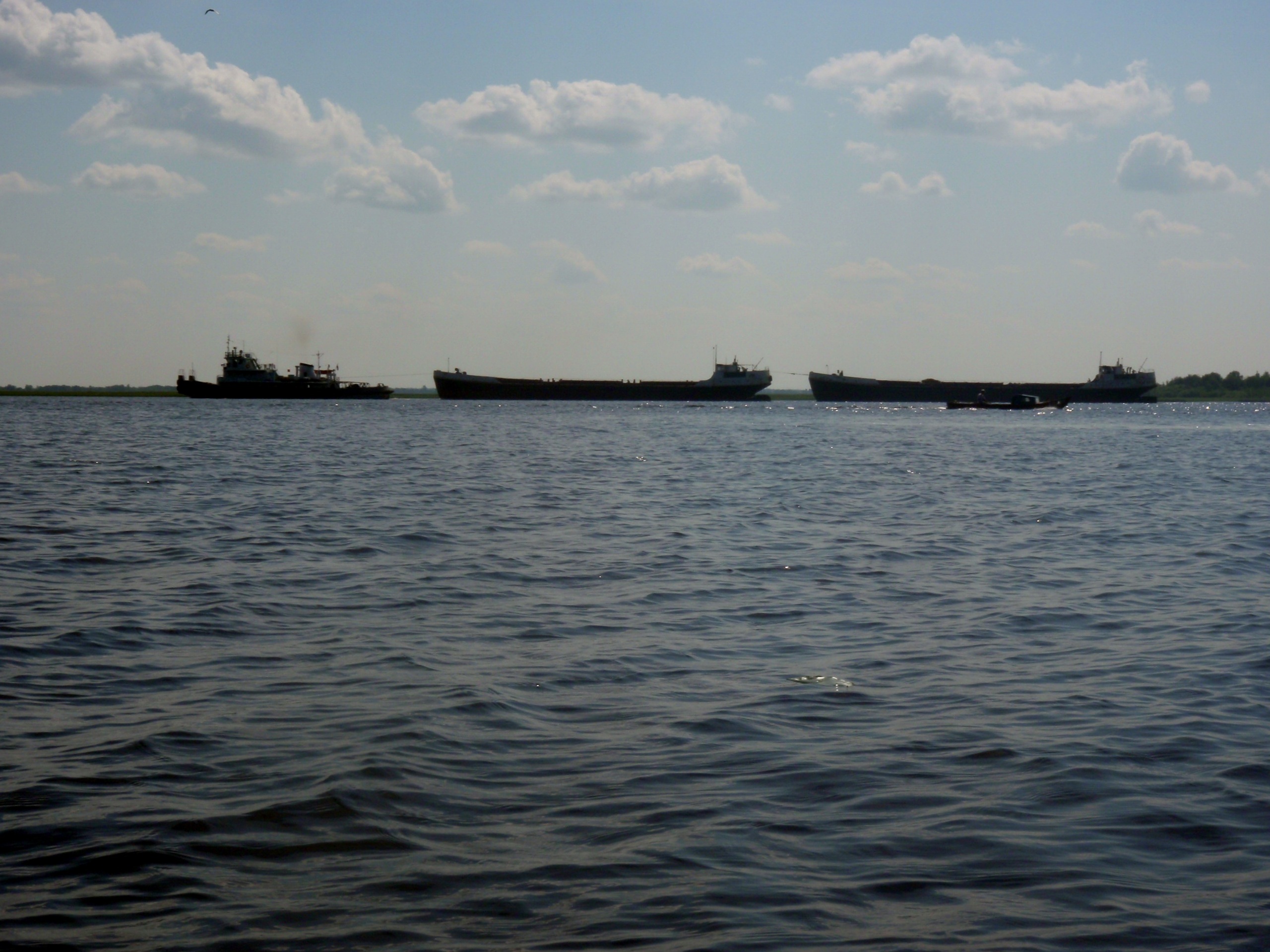
Lively traffic on the canal
Kayaking along the Ladoga canal
Between the mouths of the Svir and the Neva, along the southeastern coastline of Ladoga, there are two lockless canals going parallel to each other. One of the most important trading waterways of the Russian Empire passed via Ladoga: it stretched from the Volga River through the Volkhov and the Neva rivers to the Baltic Sea. The Ladoga section of that trade way was the most dangerous for the ships. The huge lake in this place is shallow, shores are stony, and most importantly – open to all storms, since there is no protection such as islands or skerries, as in the northern part of the lake.
The Old Ladoga Canal, also called Petrovsky, as it was named after Peter I, was 111 km long. The canal was open for vessels in 1731, and it connected the Volkhov River (at the mouth of which the city of Novaya Ladoga is located) with the Neva river (at the spot where it flows through Shlisselburg). At the beginning of the XIX century, the canal was extended from the Volkhov River to the north, up to the mouth of the Svir river.
Due to the gradual land uplift, the Staraya Ladoga canal became very shallow, and in 1861-1866, a new canal was built between the Ladoga and the old canal, named New Ladoga Canal or the canal of Alexander II.
White lateral sign. If anyone wonders where the Finnish white / red navigation signs come from, so they come from here
With the development of the railways, waterways lost their significance. Now one of the two Ladoga canals is completely overgrown, and the second one is used only by small vessels.
Pekka did not manage to find out in advance whether he could use the canal or not. The owner of the hotel had no idea in what condition the canal was (according to Pekka`s observations, Russian people generally have strikingly poor knowledge about their home area), but he tried to help and took Pekka on his quad bike to a friend who confirmed that it was possible to move along the canal on a kayak.
Moving along the canal was not easy. There was not a single breathe of wind, and the surface of water was stuffy and hot. The situation was complicated by the fact, that the steep banks of the canal did not allow to land for a short break. For the whole day, Pekka managed to make a break only twice – in both cases a fallen tree was found near the shore, allowing to stop for a while.
2 km straight forward, a small turn, again a straight line 1-3 km, and so on all the time. Hot and stuffy. One can get some shadow only by approaching the trees growing on the shore.
Shallow muddy water and comforting shopping in the end
”After good 20 kilometers, near the village of Voronovo, I noticed a beach where I could get ashore. There was also a waterway to Ladoga, and I decided to return to the lake, dreaming to find a normal sandy beach for the night camp,” says Pekka.
”Fortunately, before going back to Ladoga, I had lunch and some rest. Over more than 20 kilometers, the shore of Ladoga remained unusually bad. Only once it was possible to warm up, having moored to a large piece of wood, sticking out near the shore. At the distance of 10 meters from the shore, the kayak nose got bogged down in thick mud, and it was not possible to advance further even with the help of a paddle.
A “relief tree”. It saved from worse problems.
The heat was around 30 Co, the water was also warm, and the water supply was coming to an end. It became clear that I needed to try to get to the town of Syasstroy, located at the mouth of the river Syas. Approaching the shore, I noticed a building and three men. I asked them where to find the nearest store. Men, apparently, did not particularly understand the question, but pointed to the building.
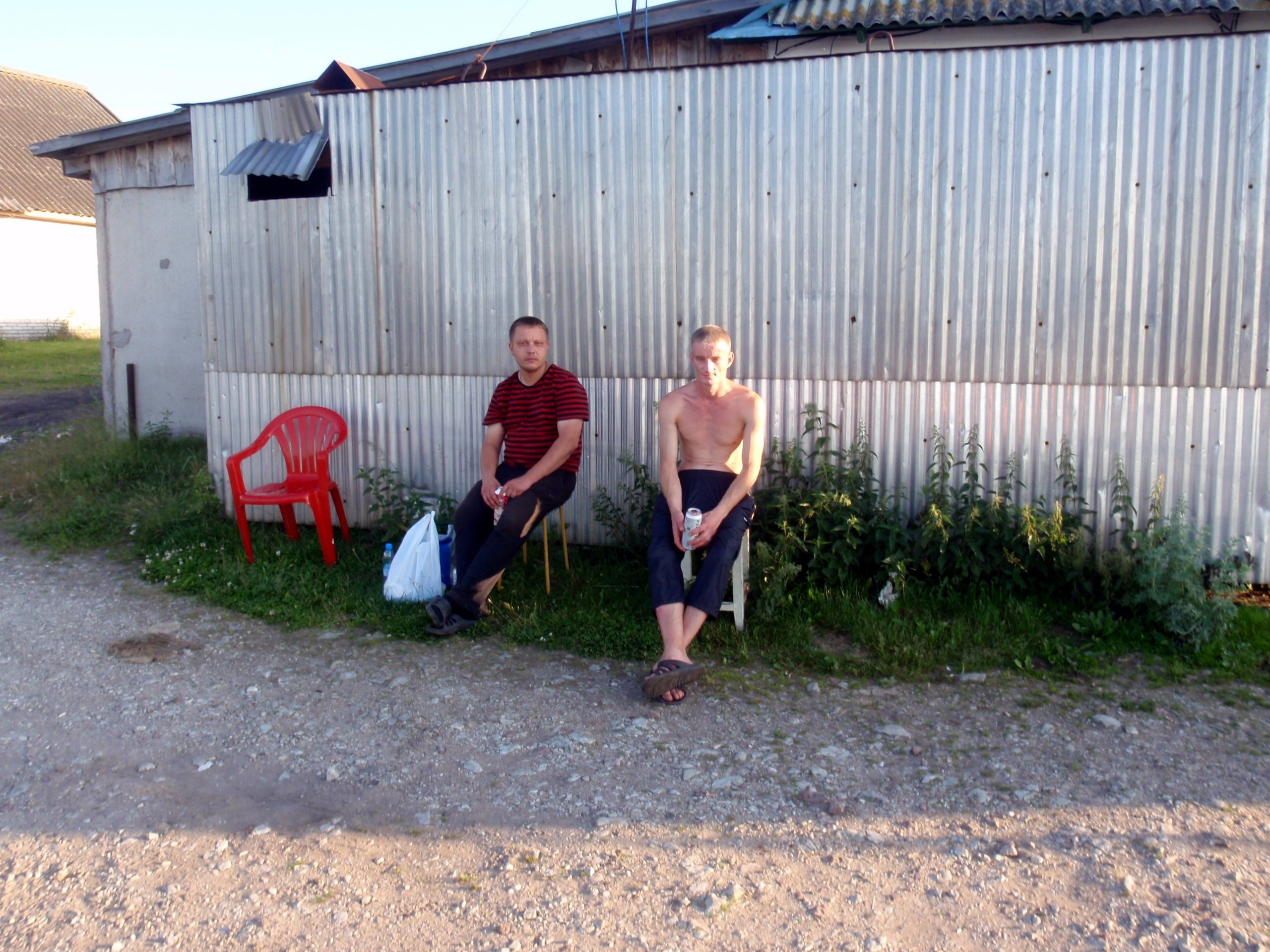
Fishmonger Andrei and his employee
The building turned out to be a fish store. The owner of the store Andrey immediately understood my situation. Without any requests from my side, he told the seller to guard my kayak left on the shore and took me by his car to a store, which was about 5 km away. At the same time, he dropped three of his workers at the gate of a facility that looked like a labor colony. In the store, I bought 3 liters of water, an ice cream and some non-alcoholic beer.
When we returned, Andrey made some tea and offered me cold tap water. I drank some, and surprisingly there were no consequences for my stomach. Andrey gave me a tour around his house, which was under repairs at that time, and on the way, he put a few packs of bills lying on the table into a box.
I called Rita and asked her to book a room at the Fishing and Hunting Club in Novaya Ladoga.
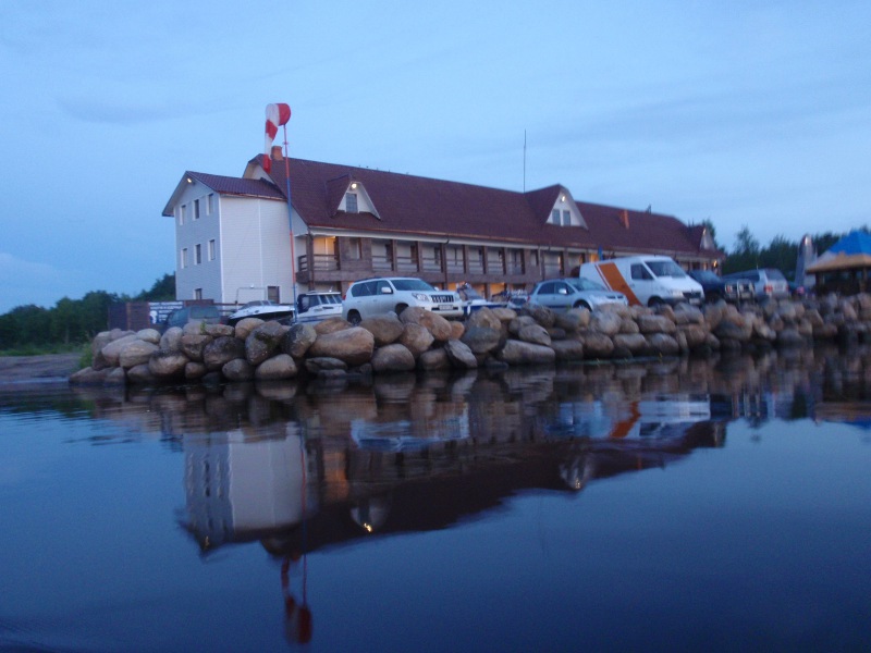
Final stop after a long day. Pekka drank 2 bottles of Baltika-0 at the counter, and it was sooo good
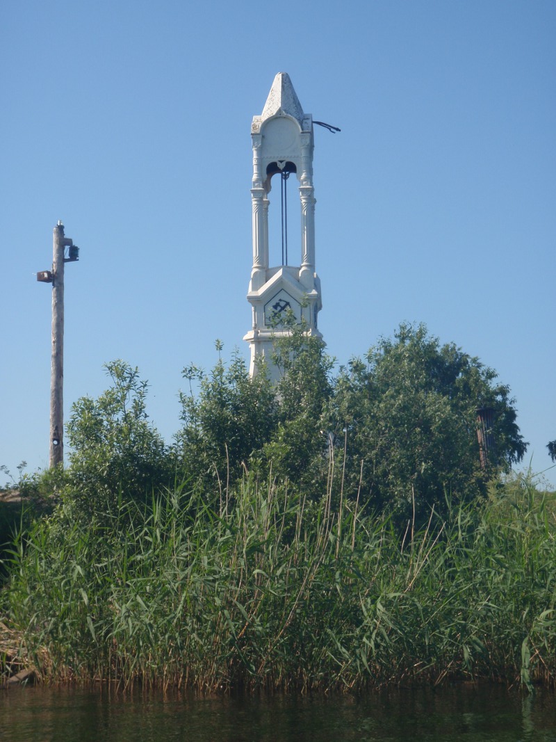
I made a decision to continue along the canal. At that spot, the canal was practically straight for almost 10 kilometers, so that the dome of the Novaya Ladoga church could be seen ahead all the way. Around midnight, I finally reached the club. The room was very hot and smelled sewerage. But the refrigerator worked, and I put my foodstuff there. The kitchen was closed, so I did not get any supper. The room cost 900 rubles (22 euros).
Novaya Ladoga – a turning point on the trade route from the Varangians to the Greeks
Pekka spent the next day in Novaya Ladoga waiting for Erkki and Anneli, who were supposed to deliver him some food for the rest of the trip. At a certain point, he realized he looked rather odd wearing his travelling clothes at that hotel, so he took a taxi and went to the local market to get a T-shirt and shorts.
The first kayak callous in life
All day, he just rested, wrote text messages, read the ”Lord of the Rings” and studied the map of Ladoga.
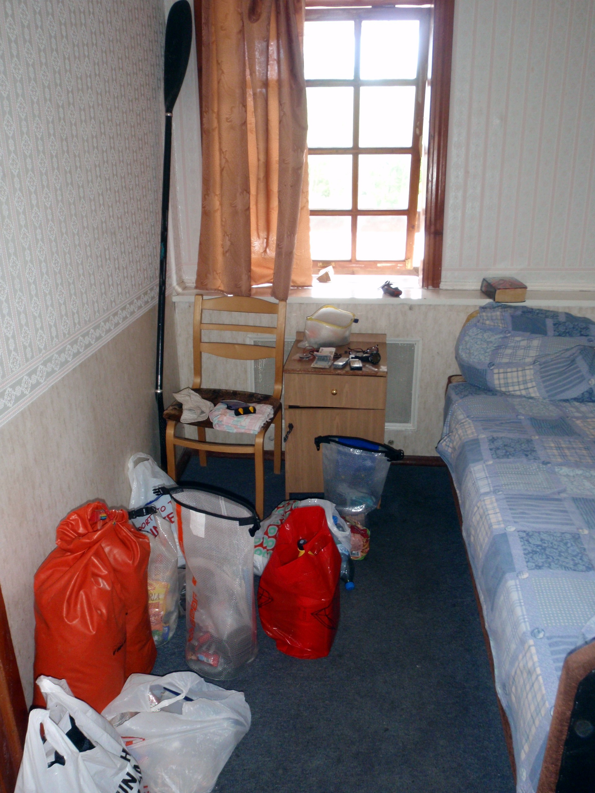
Kayaker’s goods in a hotel room
Novaya Ladoga (“New Lagoda”) is a town with a population of about 11,000 people, located at the mouth of the Volkhov River. Despite its name, it’s not a young city at all. Already in the XV century, there was a settlement, although it received a status of a town only in 1704. A town with the name Staraya Ladoga (“Old Ladoga”) is located 13 km upstream the Volkhov river. It was one of the oldest significant centers of trade, through which went the trade route ”from the Varangians to the Greeks”, the most important trade route of the Varangians, as Slavic peoples called the Vikings. Archaeologists assume, that Staraya Ladoga was founded in 753. In 2003, the town celebrated its 1250th anniversary and Putin gave it the title of the oldest city in Russia.
The Volkhov River flows into the Ladoga Lake in its southern part. Namely at the mouth of the Volkhov river the trading routes of the Vikings, starting from the territory of modern Sweden, turned south. After crossing the watershed, trade routes ran along the Dnieper river through Kiev towards Constantinople and the Mediterranean Sea.
On the bank of the Volkhov river, a hundred kilometers to the south from Staraya Ladoga, there is also a city of Novgorod, the capital of the Novgorod State, also considered to be one of the oldest cities in Russia. Through Novgorod, Orthodoxy came to Karelia. In the ”Tale of the Past Years”, Novgorod was first mentioned in the description of the year 859.
In 1136 – 1478, Novgorod was the capital of the Novgorod Republic. Sweden and Novgorod had a serious geopolitical struggle for the territory in the area of Ladoga. Later, Novgorod was annexed to the Grand Duchy of Moscow.
Today, there live 220 000 people. The city boasts numerous ancient Russian historical sites. The one interested in history and culture should definitely take a trip from Novgorod through Ladoga to Saint Petersburg.
After studying the map, Pekka decided to ask Erkki and Anneli to give him a lift to Shlisselburg by car. According to the map, the coastline between Novaya Ladoga and Shlisselburg was even shallower than on the previous segment of the trip.
”In order not to get stuck in mud and waterweeds all the time, I would have to keep a kilometer distance from the shore, not having the slightest idea of where it would be possible to get ashore. The prospect of continuing along the canal did not look bright either, as no one could tell whether there was an opportunity to get ashore. In general, the surrounding area looked strange on the map: there seemed to be a number of very small settlements along the canal, and closer to Shlisselburg – a rather large territory occupied by summer cottages, but at the same, time no regular road, and it remained unclear whether those settlements were inhabited or not. Because of the concern that there would be no suitable place to spend the night on the banks of the canal or even any possibility of getting out of it – taking into account that there were more than 100 kilometers ahead – I decided not to take that risk. You can be a little crazy, but not a fool,” Pekka summed up.
From Slisselburg to the north
Pekka arrived at Shlisselburg at about 9 pm. and spent a few more hours to get to Ladoga. The weather was magnificent, warm and calm, but still Pekka had to sweat for a while: in Shlisselburg the Neva starts from Lake Ladoga, and the counter flow there turned out to be very strong. The Neva is a powerful river carrying the waters of Ladoga, Onego and Saimaa lakes and numerous rivers through St. Petersburg to the Gulf of Finland. The difference in the altitude between Ladoga and the Gulf of Finland is 4 meters. There are no rapids on the Neva.

Oreshek Fortress. Restoration is going on. Strong counter flow of about 10 km / h
From the point of view of Finnish history, the Fortress of Oreshek (“Nut” fortress in Russian), the heart of Schlisselburg, was of great importance. Novgorod prince Yuri Danilovich founded it in 1323 on an island strategically important for defense and trade. The same year, the first peace treaty between Novgorodians and Swedes was signed in the fortress (so-called Orekhovsky Truce).
During the centuries, the fortress was destroyed and rebuilt many times. It has looked like now since 1514-1525. The fortress had a shape of a polygon 300 meters long and 150 meters wide, with seven towers along the perimeter and a three-tower internal citadel. Currently, the fortress is under reconstruction.
In terms of its historical impact and advantageous location, Oreshek is comparable to the fortress of Olavinlinna in Savonlinna, Finland. Both fortresses were alternately controlled by Sweden and Russia.
The fortress lost its military importance when Peter the Great decided to link the further path of Russia’s development with the Baltics and Europe. He founded a new capital on the marshy banks of the Neva, on the territory of Ingermanlandia, which had been dominated by Sweden for a long time and inhabited by people speaking the dialect of the Finnish language.
This happened as a result of the Northern War (1700-1721), which Peter I waged against Sweden, led by the young King Charles XII. By the beginning of 1703, Peter I managed to win back the whole territory along the Neva river from Sweden, and 10 years later, Russian troops conquered the territory of today’s Finland for the first time, and some of it remained in the Russian Empire as a result of the truce, concluded in 1721. The period of the military campaign on the territory of Finland is called ”great hatred”.
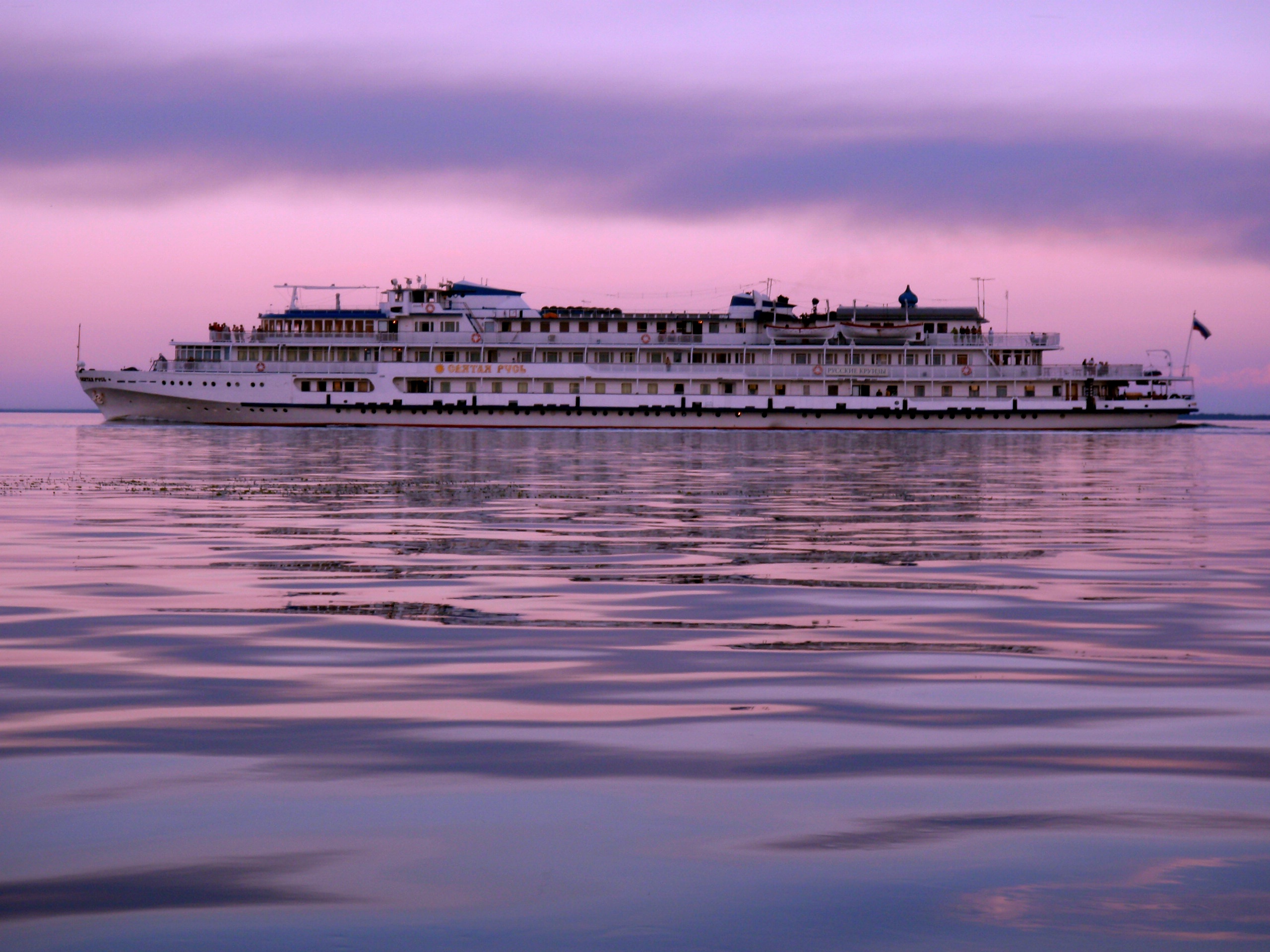
Ladoga cruise ship
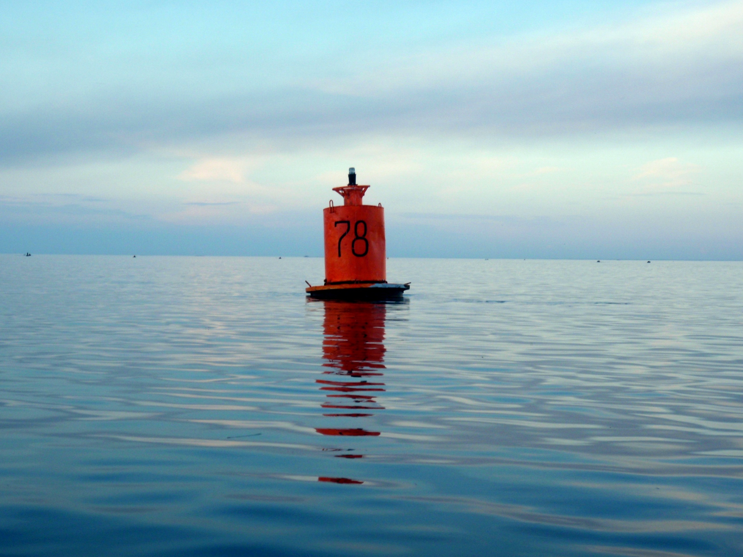
Lateral sign. On Sunday evening there were about a hundred fishermen.
Taking refuge from wind, military zone
When Pekka finally came out from the Neva to Ladoga, the night sky already started to lighten and the wind rose. In that part of Ladoga the shore was marked on the map with a red dotted line. From the kayak, Pekka saw that the road running along the shore was interrupted by a checkpoint, and a man in uniform opened the gate for each passing car.
Before the trip, Pekka tried to find out from his Russian friends whether there were any closed military zones near the shores of Ladoga. That one, at least, looked just like a military zone. However, judging by the responses of friends, there was no official information on such restricted areas. After the end of the trip, Pekka finally managed to find out that the territory behind the gate was once a military base of chemical protection troops. What is there now remained undefined.
The wind strengthened rapidly and blew from the north-west, from the side of the open Ladoga. It was necessary to find a place for spending the night, and quickly.
The coast was shallow and very stony, but behind one of the capes there was a suitable place that someone had already used as a camp. Pekka set the tent so that it could not be seen from the water. For some reason, that evening Pekka was prone to anxiety. The feeling intensified when, after a while, Pekka noticed light going from under the water, as if a bright spotlight was switched on under the water. Submarine?
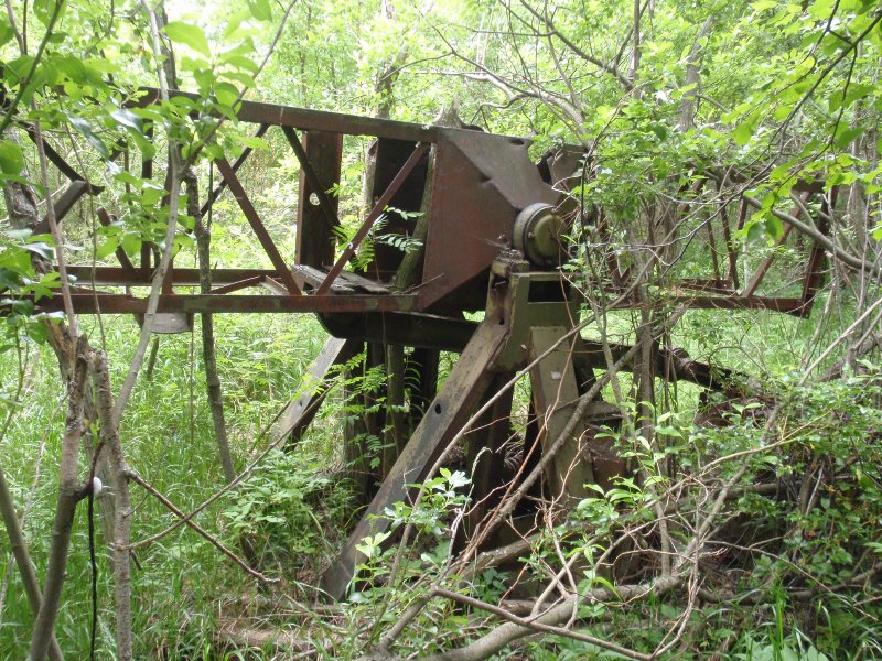
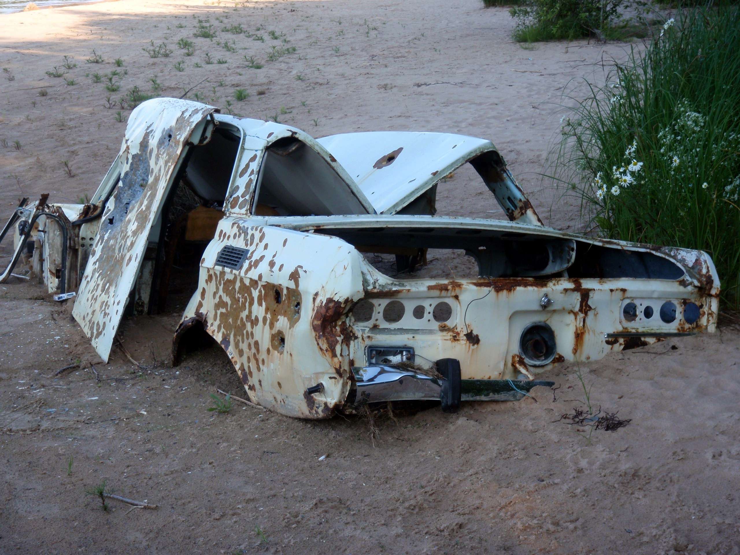
Part of some unknown apparatus in the forest near the shore.
The day passed in waiting for the wind to abate or change its direction. Neither one nor the other happened. At some point, Pekka`s attention was drawn to a bright object moving parallel to the surface of the water far from the shore. However, there turned out to be nothing mysterious: through binoculars Pekka saw a bunch of balloons, that apparently flew away from their owner.
The next morning the wind went a little down, whitecaps on the waves were no longer seen. Quick breakfast, packing up – and a jump into the kayak. However, immediately it became clear that the wind was again growing in strength. It was frustrating, but there was no other option than to return to the old place. Pekka set up the tent again, hung up the hammock and decided to relax and take it easy. “They say, hammock is very good for the back,” Pekka laughs.
Pekka set the alarm for 3.15 a.m. The wind again seemed to be going down. An hour later Pekka was already in his kayak. On the lake there were large waves that struck the board of the kayak, so it was necessary to be concentrated all the time, paying attention to each wave.
The beach remained shallow and rocky, summer cottages constantly came across on the shore.
After a couple of hours a suitable place came up, and Pekka decided to go ashore – the wind intensified again, and in the second half of the day there was not much chance of its going down. Apparently, Pekka did not yet leave the suspicious military zone marked on the map, so he tried to place the tent and things again so that they could not be seen from the water.
Pekka spent the rest of the day lying in the hammock, reading and listening to the sound of waves.
About 3 o’clock in the morning not far from the shore an air-cushion vessel, judging by the sound of its engine, was going round for a long time. “If they were looking for me, at least they did not find me,” Pekka laughs.
Towards the Burnaya river
The fifteenth day of the journey began well, a gentle headwind was blowing, and by 9 am. Pekka had already started out. The plan was to go a long way during the day.
Hotel on the river Burnaya. A nice place for a modest rest. Water in the river Burnaya comes from the same water system to which Pekka`s home lake Haukivesi belongs.
For about 20 km, Pekka could see the consequences of last year’s summer storms that hit the shores. The storms went through Finland also, and apparently caught a major piece of the Karelian Isthmus too. A lot of fallen trees could be seen. “I would not want to find myself on the water in such a wind,” Pekka comments.
By the end of the day, Pekka crossed the former border of Finland and soon reached a small village of Solovyevo, where a hotel was available, according to his knowledge. “I asked Rita to book me a room by phone, but the hotel did not respond. I had to sort it out myself. In the courtyard of the hotel, I was first met by three dogs, who barked and sniffed me, but then let me pass. They were followed by two women. I managed to take a room,” says Pekka.
“The hotel turned out to be quite good, I was allowed to put my food in a hotel fridge, which was even switched on specially for me. For dinner I had borsch, pelmeni, bread, some beer, and bottled water.
The bed was comfortable, but there was no hot water in the tap. However, I was quite ready for that, since I was aware of seasonal outages of hot water in Russia.
For breakfast, they offered me omelet of five eggs and some bread. All services – one night accommodation with food – cost 2000 rubles (about 50 euros). I can definitely recommend this hotel for an unpretentious vacation,” Pekka concludes.
The village of Solovievo (Finnish name Taipale) is located at the mouth of the river Burnaya (in Finnish also called Taipale), which is the largest branch of the lake-river system of Vuoksa. Part of the Vuoksa waters enter Ladoga through the old riverbed, located north of Priozersk, but the main water flow goes here. The old riverbed lost its importance in the middle of the 19th century, when the Vuoksa waters were redirected to Lake Suvanto to expand the arable land, and thence to the Burnaya river.
During the Winter War, a segment of the famous Mannerheim Line was built along the banks of the 11-kilometer-long Burnaya river.
Towards Sortavala and rocky shores
In Solovyovo, Pekka started to feel that there was only a final throw to do before he would see familiar northern shores of Ladoga.
A seal is waiting for a kayaker
The morning was hot and windless. The first two hours paddling felt unusually difficult. At the first break on the shore, Pekka discovered that his kayak had dragged a massive bunch of water lilies and waterweeds behind.
Kovenets Island and its monastery were in sight, but I rejected the idea of disembarking, I was urged to move on.
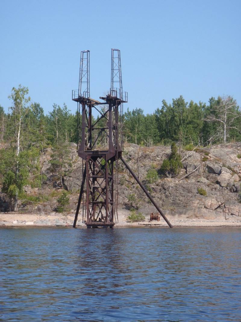
Another unknown construction on one of the islands
There were traces of that strong wind that I was waiting two days ago: plastic bottles, some wrappers and other rubbish, nailed by the wind etc. were floating. Apparently, people just drop that garbage from cruise ships, as there are no settlements nearby.
“In the evening, I had to pass around another guarded area with observation towers on the shore. I did not dare to get my camera and take any pictures. For the night camp, I chose a sandy beach, which I regretted the very next morning when the night dew soaked up the sand. Wet sand stuck absolutely all over things,” Pekka complains.
On the way to Priozersk, one can easily find traces of the war on the shore: anti-tank fortifications, monuments, etc.
Soon I passed Priozersk by, a town with a population of about 20 000 people, located at the mouth of the Vuoksa. The old name of the town, Korela, may have something to do with the origin of the word ”Karelia”. First settlements of the Ladoga Karelians were located there, expanding later to the Eastern Finland.
Someone lost it?
In Novgorod, chronicles Korela was first mentioned in 1143, and already in the 13th century a fortress was built here. In the XV century, Korela was mentioned as the second largest city of the Novgorod principality.
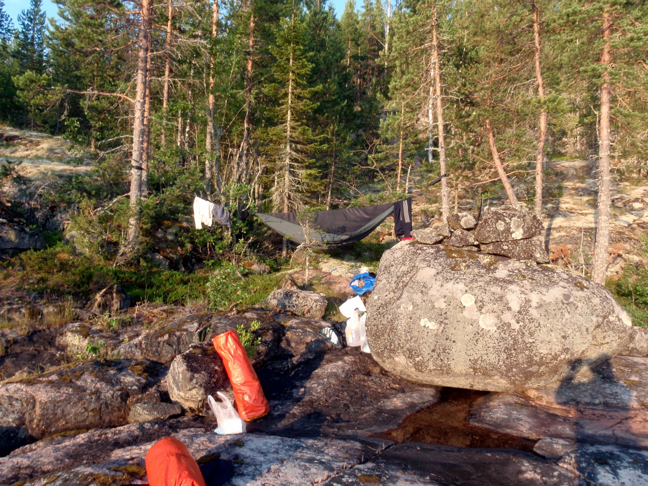
My grand-aunt used to live on the other side of this island. A hammock on this shore is the best option for sleeping.
Pekka spent the last night in the neighborhood of Lahdenpohja. In his diary, he wrote: ”FABULOUS ROCKS.” In large letters. Here began the familiar northern part of Lake Ladoga.
The final leg of the journey was easy. The weather was fine, a small wind was blowing from the east. On the pier of Sortavala, Rita was meeting Pekka with her brother. ”Babushka”, Rita’s mother, had already heated up her sauna and prepared a birch twist. “Washing myself clean felt simply divine. According to those whom I met, I looked a bit like a devil, so I shaved my beard right in the sauna so as not to frighten people,” says Pekka.
The dream is fulfilled. Ladoga is went around along the coastline.
“During the evening, I drank about 3 liters of water, and another 5 the next day. I did not have to visit the toilet almost at all. Heat combined with physical activity thoroughly disordered the fluid balance in my body.”
The dream had come true. Ladoga was went around.
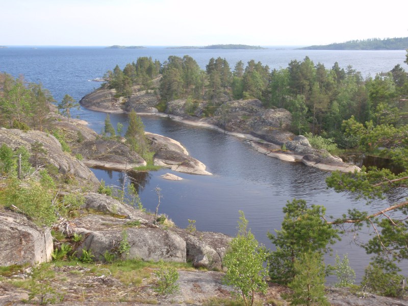
Double-natured landscapes of Ladoga
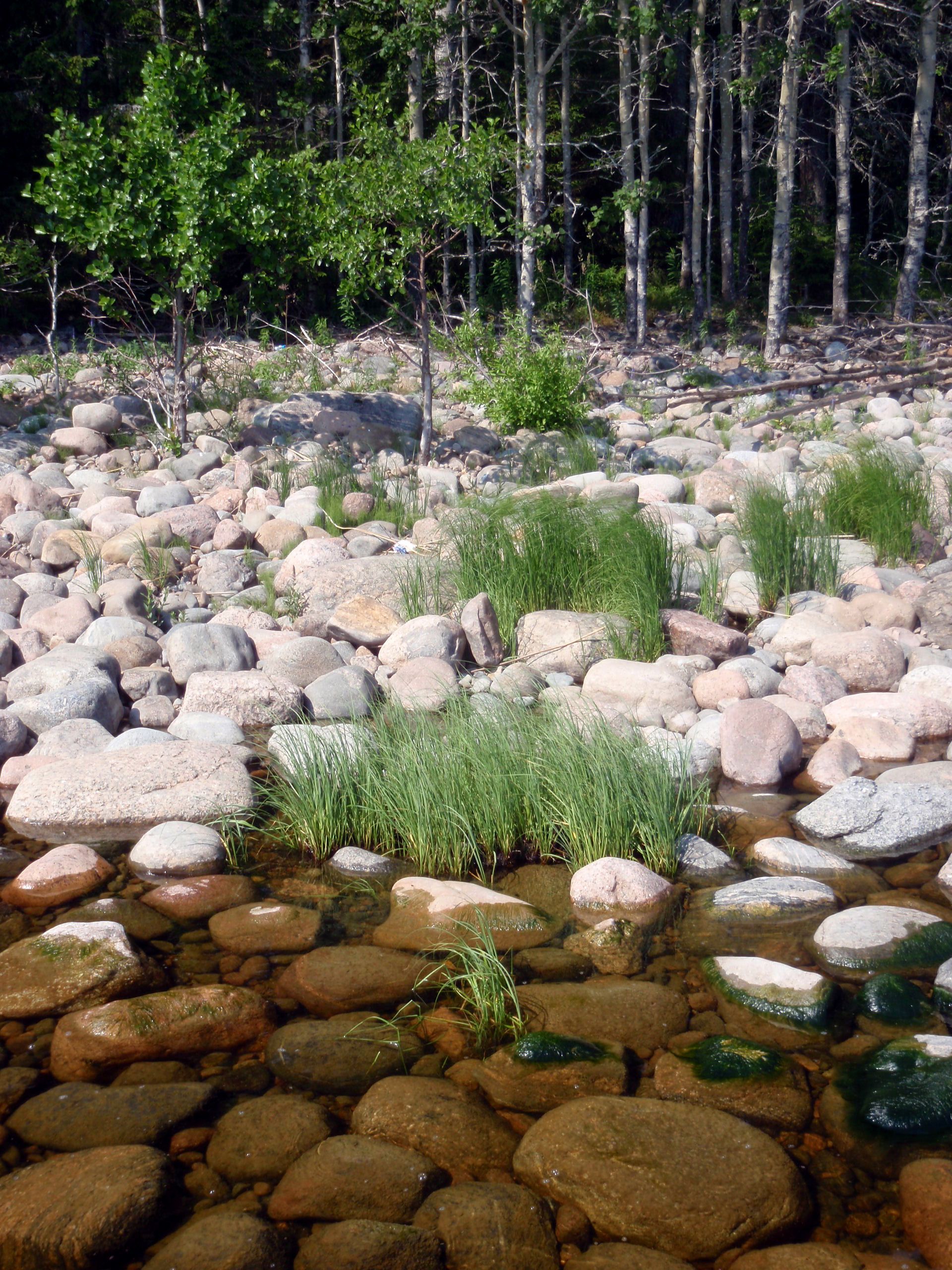
Only after passing along the entire shore of Ladoga, you realize how diverse this lake is. The northern part of the coast, the former Finnish territory, is rocky, riddled with famous skerries. In the Olonets area, there is a long sandy shoreline. The southern part of the lake is very shallow, and in order to get to the shore, one needs to wade through reeds and small stones, what is very inconvenient when kayaking. As it turned out, Ladoga canals are quite passable, but it is not possible to get ashore at any moment.
A difficult place to land
Northern part Ladoga is very deep, in some places it is over 200 meters. In the southern part, it is shallow; therefore, the banks are densely covered with reeds.
The history of the northern part of Ladoga brings so-called Lost Karelia to memory, the territory lost by Finland. Olonets will tell you about Karelian culture, and the southern shore – from the mouth of the Svir to Shlisselburg – tells about the history of Russia. In fact, such a journey makes you realize how close Finland is to the place of origin of the Russian state, and how closely the histories of our countries are intermingled. In just a few days, you can go kayaking from places that are significant for Russian history, to places that are significant for Finland.
Weather conditions on a big lake
The most important factor of any trip along such a large lake is, of course, the weather. It’s even surprising that during the incomplete three weeks of traveling I became a hostage of the wind once only.
If the wind blows from the open lake, the waves can be so huge that it’s better not to go out to the lake in a kayak or a boat. One always needs to be prepared for a sudden or strengthening wind. In the southern part of the lake, another problem is finding a place to go ashore. On the Ladoga canals, the wind is not a threat, but it is very difficult to find a place to get ashore and spend a night.
”The best time for such a trip is around Juhannus holiday (Ivanov’s day), when the wind tends to subside by night, and on a white night you can travel almost as during the day. Closer to July and until the end of summer, the beaches are flooded with tourists, mainly from St. Petersburg and Moscow. This time is extremely difficult for finding a comfortable natural beach, where there would not be anybody’s tent,” describes Pekka.
Local people are afraid of the lake
In general, Pekka came to the conclusion that modern inhabitants of the shores of Ladoga have no tradition of developing the lake and moving along it. Most of the population comes from other places, after the II World War refugees from Ukraine and Belarus were moved here. People moved to Karelia from war-ravaged territories, to the settlements, where empty houses remained after the evacuation of Finnish people.
”A huge lake remains and alien and frightening thing for them. A couple of generations are not enough to change this attitude. Of course, there are fishermen, and just people who have boats, but Lake Ladoga is unfamiliar to most people there. So, Rita, accompanying me every time in another lake trip, somehow believes that I’m very risky there, and I can be killed.”
Gear
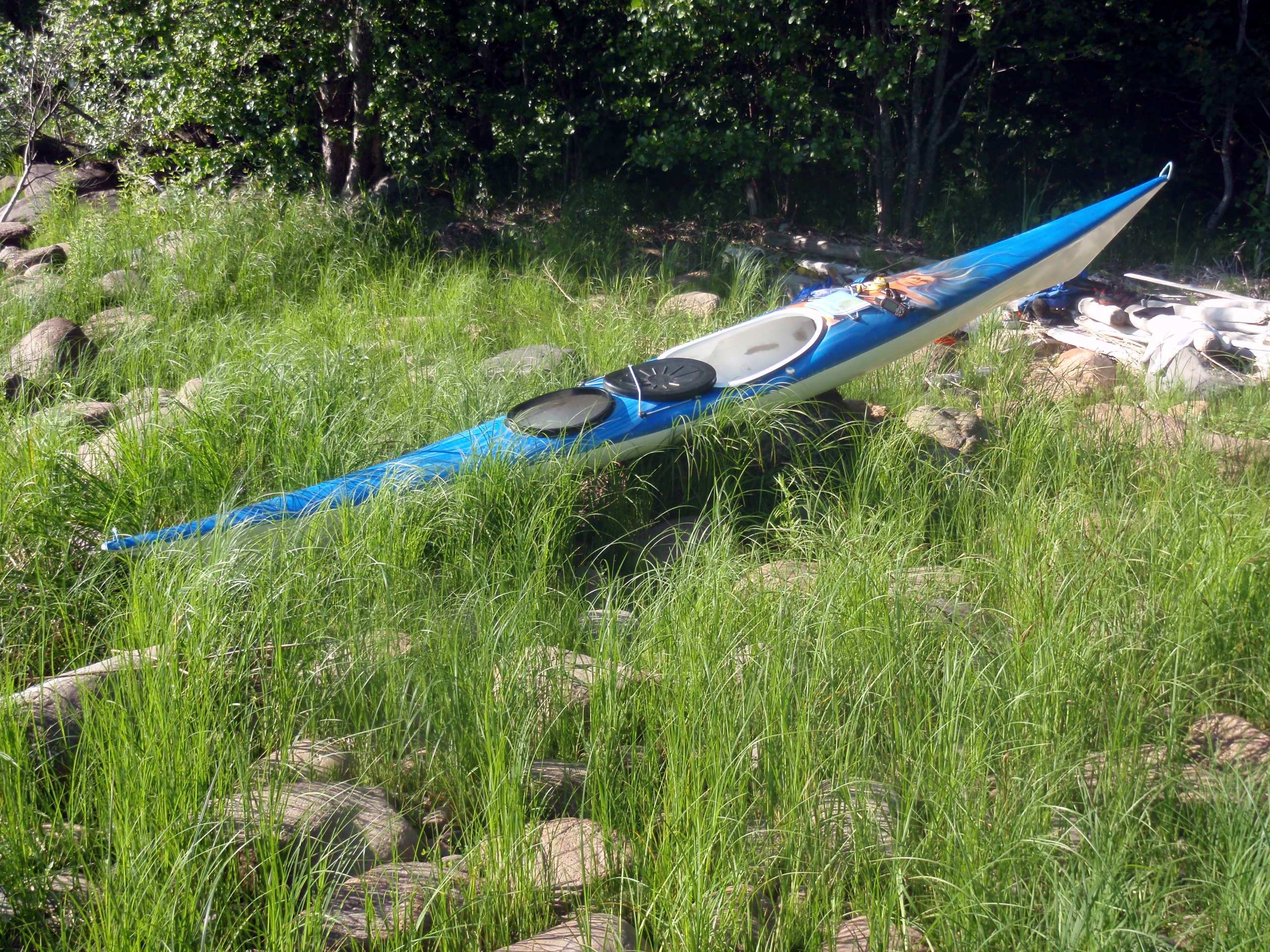
On this trip, Pekka used a hand-built kayak, a very light (only 14 kg) version of the Artisan model with additional space in the back deck for storing camping gear.
A water filter is also necessary. You can`t take enough water for 3 weeks in a kayak. In most places, water of Ladoga is probably quite suitable for drinking, but near settlements, I would not recommend anyone to drink it. Besides, when water blooms, then boiling will not help, because water becomes toxic. Some algal blooms are normal in Ladoga in summertime.
The MSR filter coped with its task perfectly, but after 3 weeks of use it had to be washed with a hard brush.
For navigation, Pekka normally uses maps and a compass, but in foggy weather and in order to determine the direction of the start, he also used a GPS navigator. Still, one should never count on a navigator alone: indeed electric appliances and water are not the best friends.
Before the trip, Pekka managed to buy a good 6-page map of Ladoga with 1: 100 000 scale in the Aino bookstore in Sortavala, and it was quite sufficient to go with.
Pekka took two mobile phones with him. One with a Finnish sim card, and the other had a Russian Megaphone one. On the eastern shore of Ladoga, there were 3 days, when both phones were out of range. No such problems near inhabited areas, of course.
Safety issues
“When I tell people about this trip, almost everyone is surprised that I did it alone. I do not see anything strange in this. On my home lake Haukivesi, I always go on a kayak all alone. It is easy: you are ready to go wherever you want, and you don`t need to fit in anyone else`s plans”, tells Pekka.
Of course, it is necessary to prepare for such a trip, so that you can be really ready to cope with possible difficulties all alone. It’s not as simple as it might seem at the first glance.
Most people unfamiliar with water trips have an incorrect idea of safety. In fact, the presence of a companion does not greatly increase the level of security. Of course, in some cases, a companion can provide a second opinion in a situation of a difficult decision-making. On the other hand, if the error does happen, there will be more victims.
Water tourism, like tourism in general, always carries certain risks. But there is a risk even when we are at home, there is no absolute safety. “I was well aware of the fact that if something happens to me, I can blame only myself, and no one else,” Pekka laughs.
“It seems to me that now people try to impose responsibility on the others too often. When one has a phone, he can easily go anywhere being sure, that if he gets tired or sick, he can call rescuers at any time, and they will take you away on a rescue helicopter.”
When Pekka goes hiking or kayaking, he tries to focus more on the thinking of people who discovered new lands, collected folklore or studied nature. Any trip should be carefully prepared, possible difficulties are taken into account, equipment is to be reliable. When the trip begins, you find yourself on your own, even if there is a fellow nearby. You need to think about your actions. A minor injury or damage to equipment can be a serious problem. It is very important to be aware of the limits of your abilities. You should never plan GGG beyond your strengths or physical abilities or to go kayaking in bad weather.
Of course, on open water, the skills of moving on a kayak must be firm. If you cannot make an Eskimo coup in a loaded kayak, this must be taken into account before venturing into the water in unfavorable weather. For example, Pekka cannot boast of such a skill, so he makes decisions in accordance with this.
Pekka`s security plan was based on the help of other people: Rita in Sortavala helped remotely, and Erkki and Anneli could relatively quickly come to the rescue by their camper. If he got sick, Pekka would receive help, although not immediately.
Planning the trip, Pekka crossed some parts of the coastline by car looking for hotels to spend several nights. Between Novaya Ladoga and Shlisselburg there was no way to get close to the water – there was no road network.
”Rescue services in Russia are called by the same number as in Finland – 112, but I did not really count on that, because I could not explain everything in Russian by phone. In case of emergency, I planned to call first of all to friends who would have already called for help.,” explains Pekka.
* * *
Pekka Pouhula`s summary of his trip: ”Indeed, Ladoga is a huge mass of water, a vast and a deep lake. In some places, there were more than 200 meters below. This is an inexpressible feeling.”
Distances
Day Distances Time spent
1. 9 km 2 hours
2. 17 km 7 hours
3. 37 km 8 hours 5 min
4. 34 km 7 hours
5. 36 km 8 hours 10 min
6. 46 km 9 hours 15 min
7. 30 km 8 hours
8. 39 km 4 hours 10 min
9. 63 km 15 hours 30 min
10. 0 km
11. 31 km 5 hours 30 min
12. 0 km
13. 0 km
14. 15 km 2 hours 30 min
15. 50 km 11 hours
16. 45 km 11 hours 20 min
17. 67 km 15 hours 45 min
18. 53 km 10 hours 15 min
Total: 573 km 125,5 hours (4,6 km/h with breaks)
Paddling strokes: 298 000. If one stroke corresponds 1 kg of resistance power, physical exercise makes 2500 kg/hour.